Visit: https://nominatim.openstreetmap.org/ui/ and search for the location.
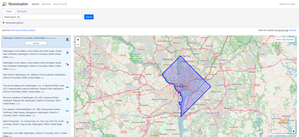
Select the Details Button on the left for the entity you are interested in.
Look for the value for the OSM relation id. In this case it is: 5396194.
Visit the following URL: http://polygons.openstreetmap.fr/index.py and enter in the OSM relation id from above. You can use on eof the original geometries selected or generate a simplified version by setting the value of X to 0 and submitting. Then click on the geoJSON link.
The geoJSON can then be imported into your database of choice such as:
INSERT INTO table set gis = ST_GEOMFROMGEOJSON('{"type":"MultiPolygon","coordinates":[[[[-77.13,38.93],[-77.04,39.01],[-76.91,38.91],[-76.9,38.88],[-76.93,38.87],[-77.03,38.78],[-77.05,38.78],[-77.06,38.83],[-77.05,38.86],[-77.13,38.93]]]]}');